
Wilkes-Barre ZIP Code Coverage
Wilkes-Barre's City Facts & Figures identifies five ZIP codes for the city: 18701, 18702, 18703, 18705, and 18706. They are postal-delivery labels, not legal polygons. The table uses the City-reported group for postal context and records routing. For any individual address, the controlling next step is an address-level USPS check, followed by a Luzerne County parcel and municipality check when a local government record is involved.
| ZIP | City-facing postal context | Post office or verification | Records note |
|---|---|---|---|
| 18701 | Central Wilkes-Barre and civic-address context | Wilkes-Barre Post Office, 300 S. Main Street | Postal code is not ward or city-limit proof |
| 18702 | City-listed ZIP with Wilkes-Barre postal-city context | Validate each address through USPS | Do not assume every address is within city limits |
| 18703 | City-listed serving ZIP | Validate each address through USPS | No authoritative detailed neighborhood or box classification was located |
| 18705 | City-listed postal-city or area context | Validate each address through USPS | Postal area and municipal lines can differ |
| 18706 | City-listed ZIP retained after the Ashley branch discontinuance | Validate each address through USPS | Postal label serves more than one municipal or community context |
The Wilkes-Barre Post Office facility is listed at 300 S. Main Street, Wilkes-Barre, PA 18701-9990. That facility detail is not a boundary map for every 1870x address. Keep the ZIP code as a mailing and routing fact, then ask the County GIS for the parcel's actual municipality code and name.
Use the USPS Wilkes-Barre Post Office source as the starting point for address-specific postal verification.
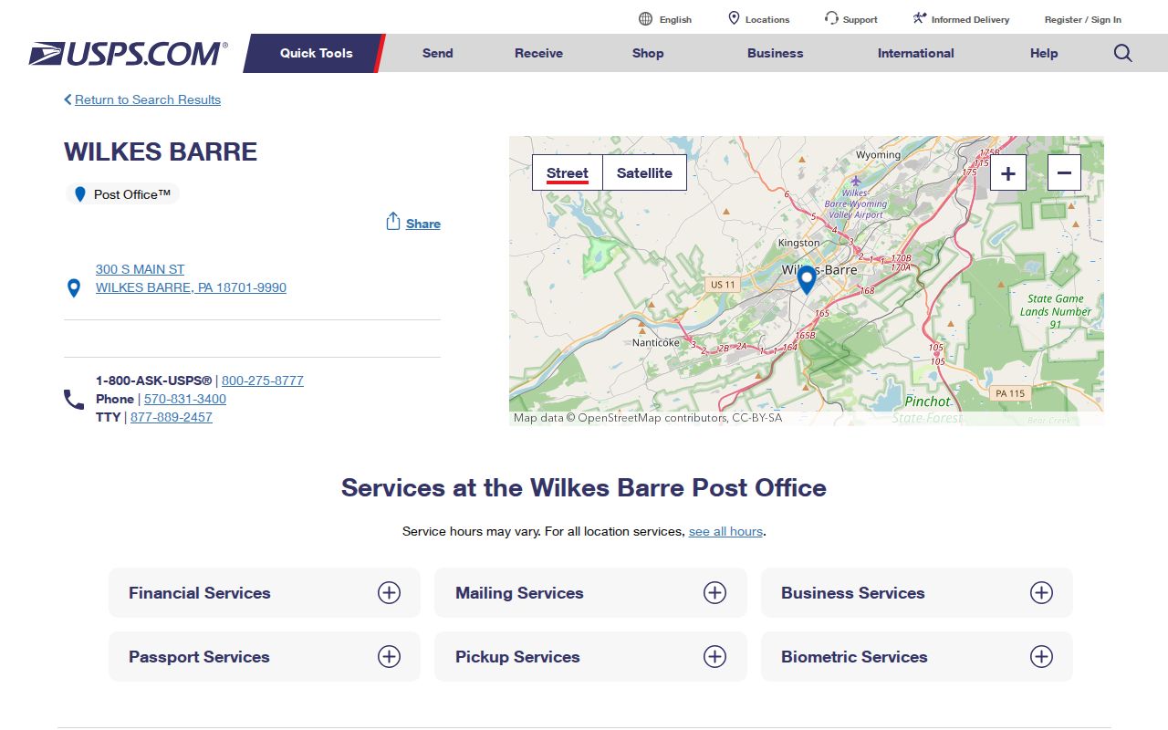
USPS verification settles the postal route for one delivery address, while municipal and parcel records answer separate local-record questions.
Wilkes-Barre ZIP Code Verification
Use USPS for the one exact address. A written address can carry an old postal convention, a shortened street suffix, or a city name that is not the municipal jurisdiction. The City-reported five-code list is a useful scope for this ZIP code directory, but it does not replace address-level confirmation. Broad web lists may attach other facility or special-service codes to the Wilkes-Barre name. Those operational relationships do not prove that the code serves an address inside the City.
- Enter the complete current delivery address into USPS ZIP Code Lookup and record the returned postal code.
- For a city or county record, enter the structure number and street name into Luzerne GIS using the abbreviated street suffix.
- Confirm the GIS municipality code, municipality name, and parcel PIN before directing a local request.
- For an old address, compare the directory year and ward or Sanborn map before treating the current ZIP as a historic match.
The ZIP code is part of a mailing address. The parcel PIN and legal description are the stronger bridge to a property or Recorder record. A tax mailing address can also differ from the parcel's situs, or street-location, address. Preserve the label each source uses instead of merging those fields into one conclusion.
Note: A USPS result is address-specific postal evidence, not a ruling on Wilkes-Barre municipal jurisdiction or a property boundary.
Wilkes-Barre ZIP Code Records
The County's documented local record tools are built around street address, parcel, road, municipality, and PIN rather than a verified ZIP-wide filter. Luzerne GIS accepts a structure number plus street name and abbreviated suffix, a partial street or PIN, map clicking, and Advanced Search. The County help explains the fixed PIN as municipality, map, block, lot, and improvement components. That makes a PIN much more stable than a postal code when a request needs to reach the right parcel or recorded document.
| GIS address or PIN search | Enter the street number and street name with abbreviated suffix, or use partial street or PIN suggestions. |
|---|---|
| Map-click parcel selection | Click a parcel as an alternative way to expose parcel data. |
| Advanced Search | A documented county property-finding path; detailed dynamic fields were not captured in the research. |
| GIS visible parcel facts | PIN, owner, assessed values, municipality, and structure-address context. |
| Treasurer tax search | Last name or business, first name or initial, parcel number, and address, with at least one partial criterion. |
There is no verified County GIS ZIP filter in the inspected instructions, and the Treasurer tax page does not expose a ZIP field. A tax mailing dataset may contain a ZIP as correspondence data, but that is not a locally verified method for searching an entire ZIP. Do not turn a postal code into an invented records filter. Use it to verify a specific address, then follow the street or PIN route.
Review the Luzerne County GIS and Mapping Portals description for the free and subscription map paths and their different parcel tools.
Search a Wilkes-Barre ZIP Code
A ZIP code can help organize a set of exact-address tasks, but the research did not find an official local assessor, GIS, or voter portal that filters all records by ZIP. The safe workflow is therefore ZIP check, address confirmation, PIN or parcel research, then a dated record source. That sequence avoids a false claim that the County can produce a complete city ZIP list from a property or voter system.
- Verify the delivery ZIP with USPS for the individual street address.
- Run the verified address through GIS or use a map click to obtain the PIN and municipality.
- Use the Treasurer search or Assessment Office only for the individual parcel or address question.
- Use the Recorder party and document trail after GIS supplies the owner or parcel bridge.
- State the ZIP, street address, municipality, and PIN in a focused records request when those fields are known.
Once a ZIP search has narrowed an inquiry to a named street, the Wilkes-Barre streets resource follows the address-to-parcel-to-deed process. It is the better route for a street-level record trail because the Recorder is party-indexed, not ZIP-indexed.
Wilkes-Barre ZIP Code Boundaries
Postal geography and city geography do different work. A ZIP Code directs mail. Wilkes-Barre city limits and wards are municipal boundaries. A parcel PIN and legal description identify property geography. A tax mailing address is where correspondence is sent. An address that carries a Wilkes-Barre postal city string or a 1870x ZIP cannot, by itself, identify the municipal office, police jurisdiction, school district, or property-tax authority that holds a record.
- ZIP Code versus ZIP+4
- The five-digit code identifies a postal delivery area; ZIP+4 adds a narrower delivery segment for a specific address or group of addresses.
- PO box ZIP
- A code used for post-office-box delivery. Research did not verify a Wilkes-Barre box-only classification for the City-listed codes.
- Unique ZIP
- A code assigned to one organization or address. No such Wilkes-Barre City ZIP was established in this research.
- Carrier route
- A postal delivery sequence. It helps mail handling but is not a municipal or parcel boundary.
For a City permit, a Recorder deed, or a court-related request, supply the actual street, number, date range, and governing office. The ZIP helps direct mail. It does not substitute for the historic street variation, ward, legal description, or PIN that the record custodian needs.
Wilkes-Barre ZIP Code Neighborhoods
Wilkes-Barre service-area labels add useful context without creating false ZIP boundaries. The City uses labels including Downtown and South Wilkes-Barre; North End, Heights, and Brookside; Mayflower, Rolling Mill Hill, Iron Triangle, and Goose Island; and East End, Parsons, and Miners Mills. These are service or neighborhood terms. They are not a postal boundary definition and should not be assigned to a ZIP without an address or parcel check.
Historic research has an additional layer. City directories begin at LCHS in 1871 and at Osterhout in 1884, long before ZIP Codes. LCHS ward maps from 1882, 1894, and 1904, plus Sanborn materials, help relate an old printed street to its historical block. Start with the dated street and ward, then make a present-day parcel bridge where the maps support it. Do not backfill a modern ZIP onto a historic directory entry as if it existed at the time.
Wilkes-Barre ZIP Code Myths
Three records are often confused: a postal city or ZIP, a tax mailing address, and a recorded owner. None proves current residence, municipal jurisdiction, or every person connected with a property. A paid GIS layer may show an owner mailing address and deed reference, while the free GIS offers owner, PIN, and assessed-value context. That documented difference is useful for parcel research, but it does not change the meaning of a postal ZIP or turn the owner field into a household list.
A postal return that looks familiar should still be checked against USPS. A tax result should still be checked against the parcel location and date. A recorded deed party should still be checked through its document and legal description. This comparison keeps a ZIP code directory focused on routing and geography rather than unsupported assumptions about people.
Practical check. Use USPS for mail, County GIS for parcel jurisdiction, and the proper custodian for the record itself. Each tool answers a different question.
ZIP Code Requests for Wilkes-Barre
When an online search stops, send a focused request to the office that holds the record. The Assessment Office, Recorder, courts, Register, GIS, and City departments do not all keep the same information. A useful request gives the exact street address, municipality, PIN when known, date range, and record type. For historic work, add the older street spelling, ward, map reference, directory year, or book and page if already found. Ask for available copy and inspection options rather than assuming a scan or a complete electronic file exists.
The Treasurer's public search is an alternate address, parcel, or name lead when GIS searching is weak. Its instructions say at least part of one field is required and that less information produces more results. Broad results are only a lead. Narrow them with the PIN, municipality, recording date, and legal description before treating them as the right property.
Open the Luzerne County Treasurer tax search when an address or parcel query needs a second county access channel.
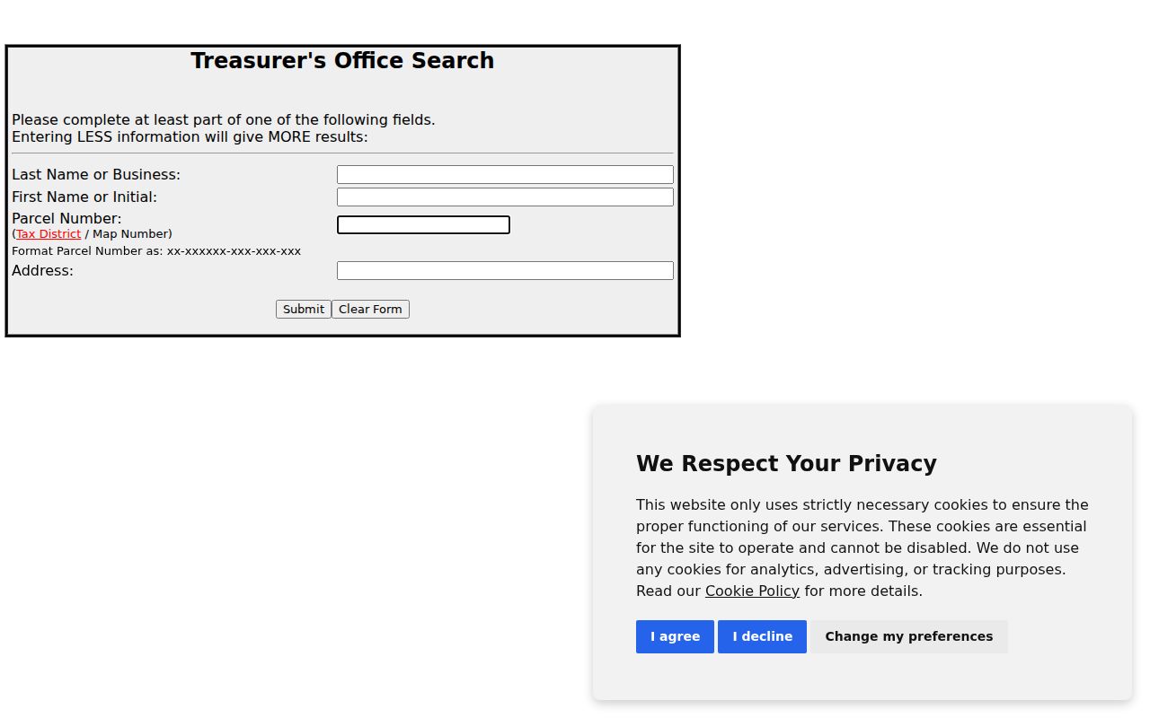
The form's name, parcel, and address paths show why county research moves from a verified postal address to the specific parcel rather than a ZIP-wide resident result.