
Search a Wilkes-Barre Street by Parcel
Start the Wilkes-Barre street directory trail with the address accepted by county GIS: the structure number, street name, and abbreviated suffix. The public map can suggest a partial address, accept a partial PIN, permit a map click, or offer Advanced Search. Its parcel result supplies the geographic bridge that a party-based deed index cannot supply on its own.
Record the parcel PIN, structure address, owner field, municipality, and the date of the map export. Then distinguish the current owner of record from a person who may actually reside there. The correct order is address or PIN, parcel, tax record, Recorder document, then historical directory or map. That process is much safer than asking a deed index to search a street name.
- Search the address in the county GIS and preserve its PIN before changing systems.
- Use the map to inspect the selected parcel and, when needed, the immediately adjoining parcel shapes.
- Request a property card from Assessment when the PIN needs a more formal county record.
- Search the parcel owner as a grantee in Landex or IQS, then match the legal description, deed date, and book-page reference.
- For a past address, select a LCHS directory volume with a street index and confirm the named household in its alphabetical pages.
Note: A street search creates a documented property trail, but it does not establish every member of a household.
Wilkes-Barre Street Directory Search Fields
The Luzerne public GIS’s search rules are specific. An address search uses a structure number and street name with an abbreviated suffix. A partial street or partial PIN may return suggestions, and a user can click the map or use Advanced Search instead. The PIN search expects its fixed characters without dashes. This local format is worth preserving because an informal address string may fail even when the parcel exists.
| County GIS control | Type | Street directory use |
|---|---|---|
| Address or PIN search bar | Text with suggestions | Enter the street address or partial PIN to locate a parcel. |
| Tax Parcels (PIN) | Layer or selector | Focuses the search on the county parcel identifier. |
| Map-click selection | Map interaction | Exposes data after a visible parcel is chosen. |
| Advanced Search | Optional tool | Alternative when the direct address entry fails. |
| Query and measurement | Free map tools | Help orient the address and parcel geometry. |
The long Luzerne PIN encodes municipality, map, block, lot, and improvement components. Keep every character. It is a stable parcel key when an older street reference no longer matches a modern display address. The county describes the free map as assessment-purpose data, not an engineering or survey product.
Open the county’s Assessment Office page for the property-card route. 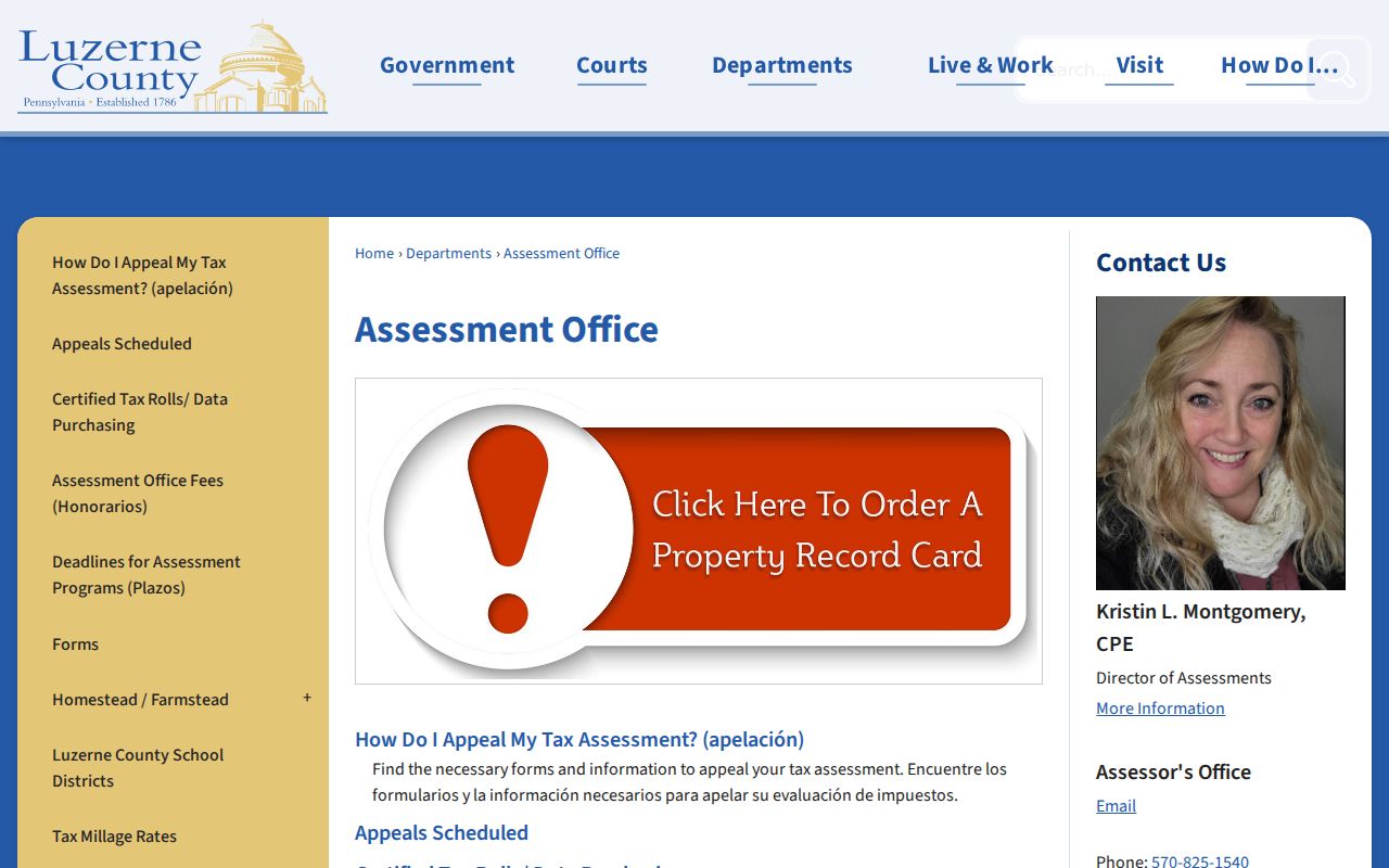 Assessment staff maintain the PIN and provide an official counter or request channel when a map field needs confirmation.
Wilkes-Barre Street Maps Have Two Tiers
The free GIS viewer shows parcel PIN, owner, assessed values, improvements, structure addresses, streets, school districts, 2024 aerial imagery, and query or measurement tools. The paid county layer adds owner mailing address, acreage, deed book and page, plate number, status, publish dates, more imagery years, and draw, select, radius, notification, and print tools. The different tiers explain why a detailed result may require an account.
A tax mailing address is correspondence information. It can be a post-office box, business, agent, trust, estate, or another non-occupant contact. Treat it as a lead for tax administration, never as a statement that the recipient lives on the Wilkes-Barre street. Similarly, a map boundary describes a parcel, not a social block.
The county’s public parcel viewer supplies the address-to-parcel path. Use the map result with its export date and the county’s assessment-purpose caution.
Wilkes-Barre Deeds Follow Parties
After selecting a parcel, bring the owner name and any visible deed reference into the Recorder’s search systems. Search a current owner as grantee, then read the legal description and any prior book-page recital. A grantee is the party receiving an interest; a grantor is the party transferring it. Search the earlier party as grantee and match the same legal description before treating it as the next link.
Luzerne requires a deliberate era change. Landex Remote covers 1968 forward and indexes images from December 1980. IQS E-Film/Infodex is the older free route for deeds from 1787 through 1967, while older grantor-grantee index books bridge through August 1, 1993. The Recorder preserves bound books and microfilm as further counter access. A street number can be absent or changed, so legal description and PIN control the chain.
- Parcel
- The mapped tax unit that bridges a street address to county records.
- Situs address
- The property’s street location, distinct from its tax correspondence address.
- Plat or plan
- A recorded map that can link a lot or block to a street and legal description.
- Criss-cross directory
- A reverse or street-indexed directory that may lead from an address to a historical listing.
Use the Landex document search to begin modern party research. 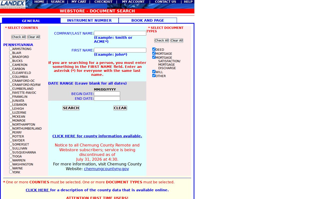 The available county, name, date, document-type, instrument, and book-page controls reflect a document search, not an address roster.
Wilkes-Barre Records Searchable by Street
A Wilkes-Barre street directory gains reliability by joining records that use an address or parcel in different ways. GIS leads to the parcel. Assessment produces a property card. The Recorder supplies the dated transaction trail. A permit or council record can describe a public project. Historical street indexes may locate a past listing. None turns into a complete or current list of people who live along the street.
| Address-keyed record | Wilkes-Barre keeper | What it supports | Access channel |
|---|---|---|---|
| Free GIS parcel map | Luzerne GIS | PIN, owner, assessed values, address context | Address, PIN, map click, or Advanced Search |
| Property card or tax record | Assessment Office and Treasurer | Parcel ID, owner, value, acreage, and sale-data fields | Counter, request, or tax search |
| Deed or mortgage index | Recorder of Deeds | Grantor, grantee, date, legal description, record placement | Landex, IQS, counter, or mail |
| Permit or code file | City Building Code Enforcement | Project, applicant, owner, contractor, and timeframe | Targeted city request or City Hall |
| Historic directory street index | LCHS, Osterhout, or NEPGS | Past listing at an address in a volume that includes an index | Library or appointment research |
The PIN and legal description create the firmest bridge between the map and deed trail. A street name is still useful for finding a parcel and browsing a historical index, but it can change in spelling or apply to subdivided lots. For a ZIP-level starting point, first verify the exact address, then move to the Wilkes-Barre ZIP lookup for postal context.
Wilkes-Barre Permits Date Street Work
City Building Code Enforcement is the address-specific municipal route when the question concerns a project rather than a property transfer. The inspected permit application asks for a start date, end date, work description, project address, and applicant, owner, or contractor contact information. It supports an address and time-frame request. It does not prove that every person associated with the work lived at the site.
No official public historical permit or code-case search was located. A focused request should give the current and historic address, a date range, PIN when known, and the precise permit, inspection, certificate, or code file sought. City Hall accepts electronic, mail, and counter workflows. A custodian decides availability, redaction, and any fee.
Wilkes-Barre Street History Uses Maps
For an older address, map the block before assuming that the current street number has always meant the same place. LCHS holds Wilkes-Barre ward maps from 1882, 1894, and 1904, while the Library of Congress offers a digitized 1910 through February 1950 Sanborn volume with 102 sheets. These maps show buildings, lot or street continuity, and ward context. They do not name households.
Research did not locate an authoritative source for a citywide Wilkes-Barre renumbering year. The defensible method is to compare the dated ward or Sanborn map, the directory volume’s street index, the modern parcel map, and the recorded legal description. When a match remains uncertain, request the relevant city planning or records material instead of inventing a continuity.
Note: A dated map can explain a changed block or address form, but it cannot identify the people who were present there.
Wilkes-Barre Street Indexes Are Historical
LCHS reports Wilkes-Barre city directories from 1871 through 2004, and some volumes contain a street index. Osterhout reports a directory run from 1884 to the present but says it is not comprehensive. For late twentieth-century work, NEPGS identifies specific telephone and cross-reference volumes, including cross-reference years 1976, 1991 through 1993, 1995, 1997, 1999, and 2001.
Choose a volume with a street index, browse the address or block, then locate the named entry in the alphabetical section and check an adjacent year. A result can show a publisher’s historical listing, not a modern person-at-address claim. The Wilkes-Barre city directory collection explains the shelves and entry fields in full.
Wilkes-Barre Street Deeds Cross Eras
The Recorder’s reach is unusually long: its first recorded document dates to 1787. That longevity does not mean one online screen covers every address. IQS provides the older deed route for 1787 through 1967, Landex Remote begins in 1968, Landex images are indexed from December 1980, and the older grantor-grantee books extend through August 1, 1993. Each cutoff changes the appropriate Wilkes-Barre street directory workflow.
Older bound books and microfilm remain important when a web index stops. The Recorder’s public terminals and a precise mail request are alternatives, while certified copies are office-only. Record Alert is a separate free service that can monitor up to five names or PINs after a new recording; it is a notification tool, not a title guarantee and not a way to monitor a whole street.
Wilkes-Barre Street Directory Limits
County GIS lists a property owner, not every person at an address. The paid GIS mailing-address field identifies the tax correspondence recipient, not a resident. A deed records a transaction party. A permit can identify a project applicant, owner, or contractor. A historic directory can omit a household or use an abbreviated name. These boundaries keep an address search from making unsupported personal claims.
A voter Street List is an official Election Code category, but it is regulated and may not be copied into an internet street display. Motor-vehicle information, utility accounts, private delivery information, and household-member data are outside this public records chain. Pennsylvania’s Address Confidentiality Program may also explain a missing or substitute address.
Use the City Open Records contact only for a defined administrative record, such as a named permit or a date-limited public file. A request under Pennsylvania’s Right-to-Know Law can be denied or redacted when another law or exemption applies. It cannot create a new street roster or override a court, voter, vital, or safety rule. Keeping the address, parcel, date, and custodian together makes a Wilkes-Barre street directory result easier to check and less likely to mislead.
Lawful use. Use Wilkes-Barre street records for personal, civic, family-history, or property research within the law. Do not use address information to stalk, harass, intimidate, or harm anyone.